NAIROBI, Kenya, Sept 4 – Governments across Eastern and Southern Africa are under pressure to expand conservation while meeting the global goal of protecting at least 30% of terrestrial, inland water, coastal and marine areas by 2030.
The target is part of the Kunming-Montreal Global Biodiversity Framework, adopted by 196 countries at the UN Biodiversity Conference, COP15, in 2022. Its 23 targets include a requirement for countries to establish well-connected and effectively managed protected areas.
But meeting the target requires more than designating land and water for conservation. Governments need accurate data showing where ecosystems and threatened species are located, how they are changing and whether protected areas are connected and effectively managed.
That data is often scattered across government agencies, research institutions and conservation organisations, making it difficult to build a consistent picture of biodiversity across borders.
The Regional Centre for Mapping of Resources for Development (RCMRD) is addressing the challenge through its Regional Centre of Excellence (RCoE) for Biodiversity, Forests and Seascape Ecosystems Management.
The initiative covers 24 countries in Eastern and Southern Africa and provides biodiversity maps, geospatial data, policy support and technical training to help governments plan and manage protected and conserved areas.
A central component is the RCoE Geospatial Platform, a cloud-based system that brings together satellite imagery, biodiversity information, forest data, protected-area maps and other environmental datasets.
The platform is designed to give governments a shared view of their ecosystems and help them identify conservation priorities, monitor environmental changes and generate evidence for biodiversity reporting.
AWS provides the cloud infrastructure supporting the initiative, allowing large volumes of geospatial and Earth observation data to be stored, processed and accessed digitally.
The system also supports the global 30-by-30 agenda, particularly Target 3 of the Kunming-Montreal framework, which focuses on effectively conserving and managing at least 30% of the world’s terrestrial, inland water, coastal and marine areas by 2030.
The RCoE programme runs from 2024 to 2028 and covers countries including Kenya, Ethiopia, Rwanda, Tanzania, Uganda, Zambia, Zimbabwe, Botswana, Angola and South Africa.
The initiative received international recognition in 2026 when RCMRD won Esri’s Special Achievement in GIS Award. Esri cited the centre’s use of GIS and Earth observation technology to strengthen biodiversity conservation and support evidence-based environmental decisions across the region.
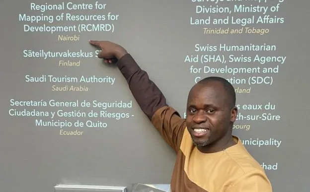
We spoke to Ngugi Kimani, Geospatial Data and Technologies Manager at RCMRD, about the RCoE Geospatial Platform, what the Esri award means for Africa’s geospatial community, and how cloud-based technologies and Earth observation are changing the way governments across the region collect, analyse and use environmental data.
1. What challenge is the RCoE Geospatial Platform solving and why does it matter?
Across Eastern and Southern Africa, countries are making critical decisions about where to protect forests, restore degraded landscapes, manage wildlife and respond to climate change, yet much of the information they need is scattered across institutions, stored in incompatible formats, or simply unavailable to decision makers.
Without integrated systems, countries cannot credibly track whether they’re protecting the ecosystems, their populations, economies and climate resilience depend on, let alone report that progress to the world. A region racing against a 2030 deadline cannot afford to make that case on guesswork.
That’s the gap Regional Centre of Excellence (RCoE) for Biodiversity, Forests and Seascape Ecosystems Management was built to close. It is a component of the Africa Regional Centres of Excellence (ArcX) programme funded by the European Union and co-implemented by the RCMRD and Landscape Alliance. The platform brings together trusted biodiversity, protected area, satellite and environmental data into a single cloud-based system so governments, conservation organizations and researchers can access the same up-to-date information and make faster, evidence-based decisions.
2. What measurable impact has the platform achieved to date?
Since launching in October 2024, the RCoE Geospatial Platform has grown into a regional conservation resource. RCMRD has trained more than 5,000 people in geospatial technologies by combining satellite imagery, mapping and geographic data to support conservation planning while building an online community of over 1,100 members and engaging more than 3,200 participants through arts and mapping competitions designed to raise biodiversity awareness.
The platform has also strengthened regional cooperation. RCMRD has signed 17 data-sharing agreements and expanded collaboration through four strategic partnerships to improve access to environmental information. New analytical tools, including Geo Hex, are being developed to help governments identify priority areas for conservation, ecosystem restoration and biodiversity protection more accurately across national borders.
3. Can you share a real example where the platform made a measurable difference?
Kenya’s commitment to protecting 30% of its land and sea by 2030 depends on accurate information about existing protected areas and important biodiversity sites. Through the RCoE platform, Kenyan conservation agencies accessed standardized geospatial information that supported protected area planning, biodiversity reporting and national decision-making.
During the preparation of Kenya’s Seventh National Report to the Convention on Biological Diversity (CBD), the platform enabled technical teams to work from a common, authoritative data source, significantly reducing time spent collecting and validating information from multiple agencies. RCMRD supported the consolidation of Kenya’s protected area data into a centralized geoportal and worked closely with the government to coordinate data collection, compile datasets and successfully submit the report.
This evidence-based approach contributed to Kenya’s successful mobilization of international financing, including support from the Kunming Biodiversity Fund and the Global Environment Facility (GEF) through the United Nations Environment Programme. These resources are now being used to assess remaining biodiversity gaps and update Kenya’s National Biodiversity Strategy and Action Plan (NBSAP), ensuring national conservation priorities align with KM-GBF goals.
This same evidence base underpins the recently launched Biodiversity Outlook for Eastern and Southern Africa (BOESA), a flagship regional outlook delivering geospatial intelligence to conserve nature and empower communities sustainably across the region. BOESA offers a comprehensive assessment of biodiversity, forests, and seascapes, consolidating regional data, country-level insights, and emerging trends into a single platform bridging science, policy, and implementation. It also features three key tools: WDPCA Validator an AI tool that simplifies protected area reporting; 30×30 Tracker which tracks progress toward the 30×30 target and the KM-GBF Capacity Needs Assessment (CNA) Tool, a web-based platform helping institutions assess, track, and plan capacity development in support of the KM-GBF.
4. Why is this work particularly relevant in the context of climate change?
Across Eastern and Southern Africa, ecosystems face increasing pressure from climate change. Conservation decisions made too late, or made without evidence, are decisions that can’t be undone – a wetland drained, a species pushed past recovery, a protected area degraded beyond its buffer capacity. The near-threatened status of species like the Southern White Rhino is a reminder that the region’s conservation challenges are unfolding in real time, on a clock with a hard deadline.
The RCoE feeds directly into KM-GBF Target 3 by integrating systems that track what’s happening on the ground, replacing fragmented and inaccessible data with a platform built to support countries with better, faster decision-making.
5. How has AWS enabled or accelerated this impact?
AWS removed the infrastructure ceiling. Instead of building expensive physical infrastructure that individual countries would struggle to maintain, the platform securely delivers geospatial services across 24 nations from a single cloud environment. As demand has grown, the platform has scaled without interruption allowing thousands of users, from protected area managers and researchers to government ministries, to access the same information regardless of location.
Amazon S3 (Simple Storage Service) stores and serves the platform’s heaviest geospatial products including satellite imagery layers, biodiversity datasets and interactive map books giving nearly 900,000 geoportal visitors on-demand access to data that would otherwise sit locked in local servers or shipped on hard drives.
Amazon EC2 (Elastic Compute Cloud) and AWS Amplify enable new tools and services to be deployed in days rather than months, allowing additional countries to access spatial tools for biodiversity reporting and enabling the 30×30 Target 3 Tracker to ingest protected area data from 24 nations simultaneously without bottlenecks.
Perhaps most critically, AWS-hosted training infrastructure enabled RCMRD to train more than 5,000 participants concurrently on conservation planning and spatial analysis tools. This scale would have been physically and financially impossible through traditional delivery.
And finally, the outcome is not simply a technology story but an accessibility story. A protected area manager in Mozambique and a policy analyst in Ethiopia can access the same platform, the same data and the same analytical tools with the same speed and reliability as someone in Nairobi. AWS has made the RCoE’s impact borderless, always on and scalable, allowing the platform’s reach to grow faster than the biodiversity challenges it was built to address.